New 3D data for NRW: Precise and photorealistic terrain models
2025-07-01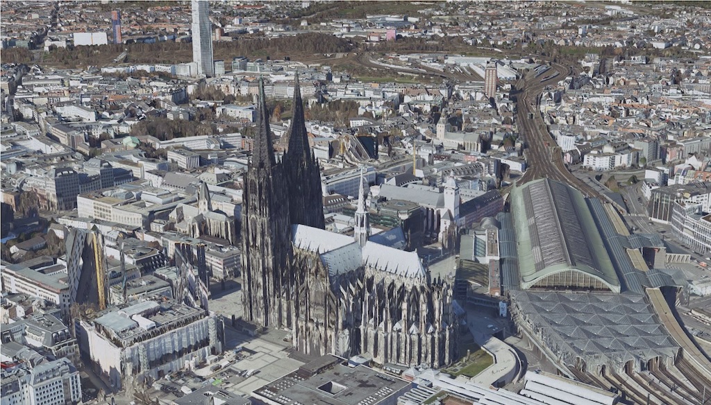
Geobasis NRW is now providing a high-resolution 3D mesh for North Rhine-Westphalia. Based on aerial photographs, it offers a photorealistic, 3D representation of the Earth's surface, including vegetation, buildings, and man-made objects.
The current version, which has been in use since the 2023 flight year, has a 2.5D resolution: this means that only one elevation value is available for each 2D location coordinate.
The 3D mesh of North Rhine-Westphalia from Geobasis NRW is ideal for a wide range of applications in geosciences, urban planning, environmental monitoring, and innovative developments such as open source tools and digital platforms.
Highlights:
- Spatial coverage: North Rhine-Westphalia
- Flight period: 2023–2024
- Resolution: 10 cm ground resolution (GSD)
- Reference system: EPSG:4326 – WGS84
- File formats: 3D tiles (b3dm), CSV, SHP
- Use: Comprehensive coverage for a wide range of applications
The data can be accessed via the CODE-DE platform, where it is provided in 3D tiles (b3dm) format and with metadata in CSV and SHP format. Registration is required for download. Further information can be found in the portfolio entry.

Technical Implementation and Operation:

Financed by: